Back to Blog
How High-Fidelity Virtual Experiences Are Shaping Urban Development
Sep 19, 2023
Callum Moates
The metaverse, described as the 3D internet, is an immersive virtual environment that works in cohesion with a range of technologies like augmented reality (AR), virtual reality (VR), digital twins and artificial intelligence (AI). These capabilities have opened doors for city planning, development, and administration opportunities. Governments can build digital twins of cities and infrastructure in the metaverse to optimize efficiency, simulate changes, and ensure sustainable development. Government agencies creating smart city projects can enhance operations through the 3D internet for real-time decision-making, citizen engagement, and emergency scenario planning. As the lines between the virtual and physical worlds blur, the metaverse is poised to revolutionize how cities are conceptualized, designed, and experienced.
The metaverse and urban planning
With its expansive and malleable digital landscapes, the 3D internet is emerging as a revolutionary playground for architects and urban planners. Its virtual realms offer unparalleled opportunities for experimentation, allowing professionals to visualize, modify, and test urban designs in unimaginable ways. Here's how:
Risk-free experimentation: In the metaverse, architects can play with bold and innovative designs without the constraints of physical materials, budgets, or immediate real-world implications. This freedom fosters creativity and encourages risk-taking.
Real-time collaboration: Multiple stakeholders, from architects to city officials to residents, can converge in the virtual space, collaboratively designing and providing real-time feedback. This collaboration democratizes the design process, making it more inclusive. To improve on any input, architects can instantly tweak their designs without the time-consuming revisions required in traditional methods.
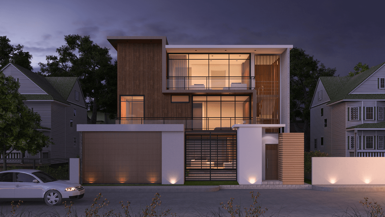
Immersive project visualizations: Unlike 2D blueprints or even computer-aided design (CAD) models, the metaverse allows planners to walk through their designs, offering a first-person perspective of the urban spaces they're creating. This immersion can lead to more intuitive and user-centric design plans.
Here are some examples of virtual urban planning tools:
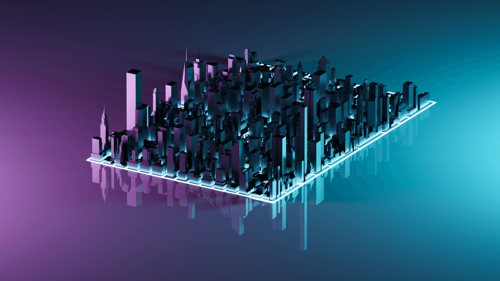
3D design and visualization tools: Urban planners can use tools like Twinmotion and Unreal Engine to design 3D models of projects in high fidelity to enhance conceptualization, simulate urban scenarios, and improve stakeholder communication. Twinmotion is a real-time visualization tool that allows architects and designers to transform CAD data into detailed urban visualizations. It offers a range of weather and lighting scenarios to test how different environmental conditions impact a design. On the other hand, Unreal Engine is modernizing urban planning with its real-time 3D technology. V2i Real-time, an Australian studio, used Unreal Engine for a detailed 3D modeling of their Figtree Hill project, a new precinct in south west Sydney. Similarly, Cityscape Digital in London utilized the engine for their Canada Water urban regeneration project, offering a vivid visualization of the construction in progress for stakeholders to access.
Augmented and virtual reality (AR and VR): AR and VR enable planners to preview proposed developments, enhancing understanding and public engagement. AR applications can add virtual elements to physical projects to envision a finished project, or VR headsets can be used to tour proposed ideas virtually. CityEngine's integration with Virtual Reality (VR) offers an immersive experience, enabling planners to ‘walk through’ and interact with the urban environments they design. This VR capability enhances visualization, facilitates stakeholder engagement, and aids decision-making by providing a lifelike representation of proposed urban developments.
Virtual metaverse platforms: Virtual metaverse environments are shared spaces that facilitate collaborative urban planning through immersive visualization, scenario testing, public engagement, and data analysis. Minecraft, a popular 3D internet platform, has been innovatively used by UN-Habitat for urban planning initiatives, mainly to engage youth in the design of urban public spaces through participatory design workshops in various global locations, including Kibera in Nairobi and Les Cayes in Haiti. In these workshops, participants visualize their urban design ideas in Minecraft and present them to local authorities. This interactive approach has proven effective in enhancing community engagement, understanding, and dialogue in urban planning processes.

Virtual real estate and digital twins
A digital twin is a virtual replica of a physical entity or system. In urban development, a digital twin can represent an entire city or specific elements, such as buildings, infrastructure, or utilities. These digital models are not just static representations; they are dynamic and can be integrated with real-time sensor data collected through the Internet of Things (IoT), allowing for continuous monitoring and analysis. The metaverse works as a 3D user interface for IoT devices, visualizing real-time changes.
Here’s how digital twins in the metaverse help urban development:
Predictive analysis: By integrating real-time data in 3D digital twins, city planners can predict potential issues, such as traffic congestion or infrastructure wear and tear, and proactively address them.
Optimized resource management: Digital twins can help in efficient resource allocation, be it water distribution, energy consumption, or waste management.
Simulation and testing: Before implementing changes in the real world, planners can simulate them in the digital twin environment to gauge their impact.
Buying and selling virtual real estate within the metaverse
The appeal for virtual urban projects in the metaverse is not limited to prototyping and testing designs for physical execution. There is an emerging demand to buy and sell virtual buildings, storefronts, and event venues among users and businesses. Virtual real estate in the metaverse is akin to physical land, available for purchase, development, and lease. As the digital and physical worlds converge, the value and potential benefits of owning virtual space are rapidly escalating, reshaping our understanding of digital assets and interactions.
The worth of virtual real estate is primarily determined by its location within the metaverse, size, and developmental potential. Prime spots, especially those adjacent to famous virtual landmarks or hubs, naturally fetch higher prices. This dynamic landscape has attracted speculators, much like in the physical world, who invest in these digital plots anticipating lucrative returns, leading to a thriving market where some properties have exchanged hands for millions in real-world currency. Recognizing the potential of virtual estate, businesses, and brands are also diving in, securing virtual spaces to craft unique experiences, launch products, or fortify their marketing endeavors.
For instance, a piece of virtual real estate in Decentraland was sold for $2.4 million in cryptocurrency. The digital land was acquired by Metaverse Group, an affiliate of Tokens.com, for 618,000 MANA (Decentraland’s native currency) in November 2021. This land, located in the ‘Fashion Street’ area of the Decentraland map, is intended to be used by Tokens.com to host digital fashion events and sell virtual clothing.
Sustainable urban design in the metaverse
By harnessing the capabilities of the metaverse, cities can embark on a path of sustainable development, ensuring that they meet the needs of the present without compromising the ability of future generations. With the advent of 3D modeling and simulations in the metaverse, architects and urban planners have powerful tools to design sustainable and efficient urban environments. Here are a few ways to create sustainable urban designs in the metaverse:
Energy efficiency: Simulations in the 3D internet allow for optimizing a building’s design by analyzing how sunlight interacts with structures throughout different times and seasons. This information can guide decisions on window placements and building orientations to minimize energy consumption for heating and cooling.
Resource and transport optimization: Through 3D models, planners can visualize the flow and consumption of resources within a city, leading to the design of efficient water, waste, energy, and transportation systems. By predicting traffic flow and peak congestion times, cities can develop roads and public transport networks that reduce pollution and congestion.
Ecosystem preservation and carbon analysis: Before embarking on urban projects, the metaverse can simulate their impact on local ecosystems and their carbon footprint. This simulation ensures that developments are ecologically balanced, preserve local flora and fauna, and are aligned with climate change mitigation efforts. A report by EY estimates that using digital twins for projects can help reduce a building’s carbon emissions by 50%.
Smart cities
Governments are building smart cities intending to use technologies to improve operational efficiencies and the lives of citizens. The metaverse, a collective virtual space that leverages immersive and 3D technologies, offers unparalleled opportunities to elevate city and infrastructure development and improve governance. Integrating data collected from data sources like IoT sensors and cameras around the city, the 3D internet could create real-time data visualization, simulation, and resident interaction. This ability makes the metaverse ideal for decision-making, administration, and engagement.
Here’s how governments can use the metaverse for better city management:
1. Real-time decision-making: Data from urban sensors, such as traffic cameras, air quality monitors, and energy consumption meters, can be fed into the metaverse in real-time. City managers can then use this data in the virtual world to make immediate decisions, such as rerouting traffic during congestion or adjusting street lights based on pedestrian movement.
2. Enhanced citizen engagement: The 3D internet can serve as a platform for citizens to engage with their city's management. Residents could attend virtual town hall meetings, provide feedback on proposed infrastructure projects, or even participate in virtual city tours to understand upcoming changes.
3. Training and simulation emergency services: City administration and planners could use the metaverse to simulate various disaster scenarios like earthquakes and floods using historical and real-time data. This simulation would allow them to train emergency for specific situations, such as evacuating a neighborhood during a crisis, based on the current infrastructure and conditions of the city.
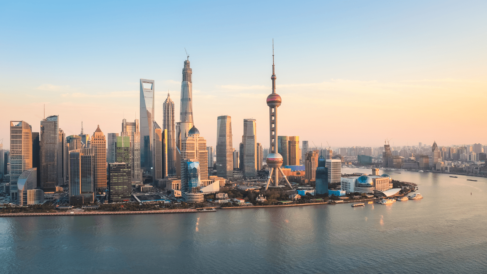
A great example of a smart city leveraging the 3D internet is Shanghai, which has developed a digital twin of the city, modeling over 100,000 elements, including road traffic, the size and location of apartment buildings, and e-bike charging infrastructure. This digital replica is used not only for planning public services but also for simulating traffic flow and the effects of potential natural disasters, such as flooding, to aid in response planning. By analyzing real-time data in this virtual environment, city officials can make informed decisions about traffic management, reducing congestion, and optimizing transportation routes.
Conclusion
The transformative potential of high-fidelity virtual experiences is set to revolutionize urban development in unprecedented ways. As we transition into the metaverse era, these virtual platforms offer sustainable solutions, citizen engagement, and data-driven urban planning. However, it's imperative to approach this transformation with responsibility. Ensuring accessibility, addressing ethical dilemmas, and balancing the virtual and physical realms are paramount.
Are you an urban planner or government body looking to use technology to enhance smart city and urban projects? We can help you build and scale digital twins in the metaverse to enhance urban planning and service delivery for citizens. Get in touch with us!
Sep 19, 2023
Callum Moates
Subscribe to our monthly newsletter
About Landvault
Landvault is building infrastructure to accelerate the metaverse economy, by building tools to create, deploy and monetize content. The company has helped over 200 clients enter the metaverse, including both Fortune 500 companies and government organizations like the Abu Dhabi government, Mastercard, L’Oreal, Red Bull, and Heineken. The company has raised a total of $40m over the past three years and continues to pioneer technological advancements.
